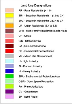
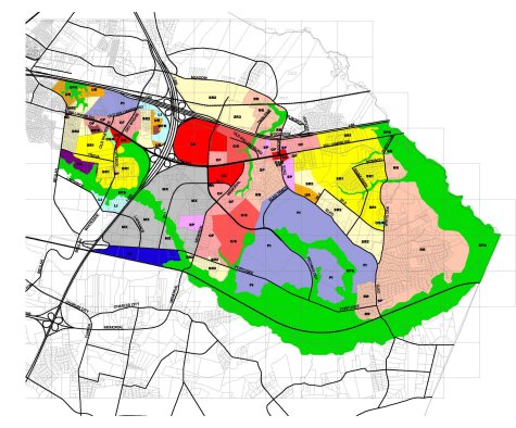
To download a printable version of the Land Use Plan Map click on the map below.
Land Use Plan

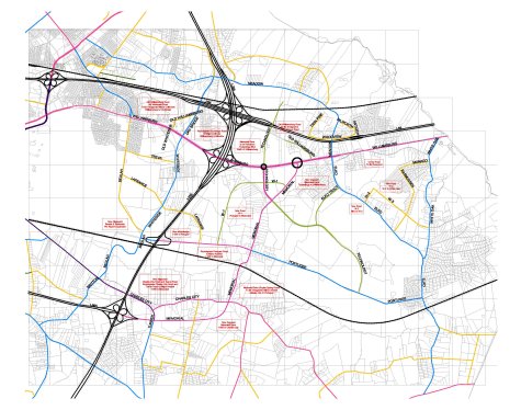
Major Thoroughfare Plan
With this Recommended Plan, a significant amount of potential traffic is envisioned along Williamsburg Road east of I-295. Therefore, at the appropriate time that development and traffic levels warrant, the intersections of Williamsburg Road & Technology Boulevard and Williamsburg Road & Memorial Drive should be converted from at-grade to grade-separated facilities. This would allow increased traffic to flow more safely and efficiently, especially through the Williamsburg Road corridor, and allow the density of developmentthat the market will likely demand in the future.
Because of its location further from the I-295 interchange to the west, the Williamsburg/Memorial intersection will likely need to be designed to accommodate more traffic than the Williamsburg/Technology intersection. For vehicles leaving or exiting the interstate and heading to destinations along the Williamsburg Road corridor, the Memorial Drive intersection would allow more time and space for lane changing and vehicle maneuvering.
Williamsburg/Memorial could become a grade-separated interchange while Williamsburg/Technology could either be an at-grade or grade-separated intersection with limited turning movements. This plan is reflected in the relative sizes of the circles marking these intersections. There is a critical need for land to be reserved for these facilities as development occurs.


