Address
Laurel Methodist Church
1919 New Market Road
Henrico, Virginia
Geo Coordinates
37.459027, -77.376665Description
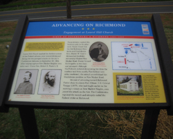
Laurel Hill Church marked the farthest extent of the Federal advance west toward Richmond during the two-pronged attacks on the city’s Confederate defenses on September 29, 1864. After helping capture New Market Heights (two miles east), Union Gen. Robert S. Foster’s X Corps division reached this location early in the afternoon. Foster found that the 3rd Richmond Howitzers and Confederate Gen. Martin W. Gary’s dismounted Confederate cavalry blocked New Market Road. Foster formed his brigades in two lines and advanced. Although the Federals endured devastating fire from the roadway and from nearby Fort Gilmer (two miles southeast), the assault overwhelmed the Confederate position on New Market Road. Instead of advancing toward Richmond, Foster chose to silence Fort Gilmer. U.S. Colored
Troops (USCT), who had fought earlier in the morning’s victory at New Market Heights, soon joined the attack on the fort. The Confederates repulsed the assault and abruptly ended the Federal strike at Richmond.


