Site menu

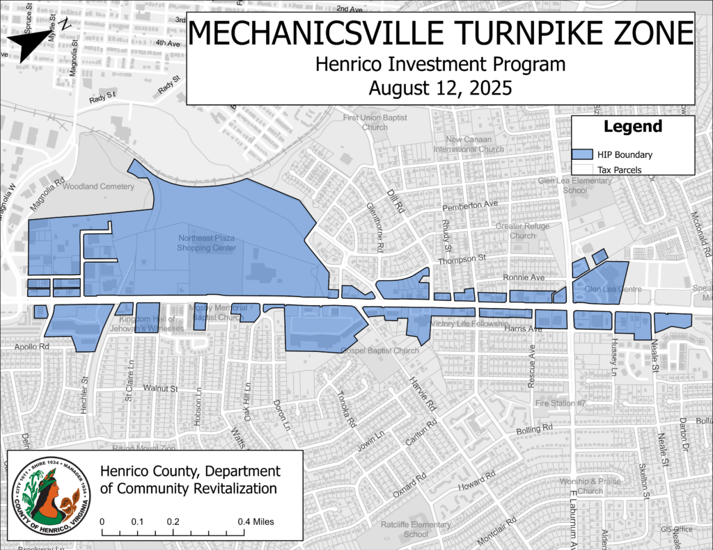
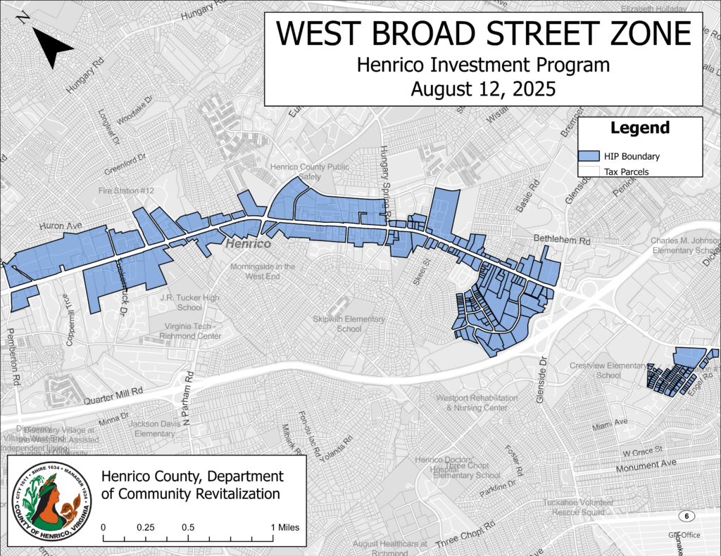
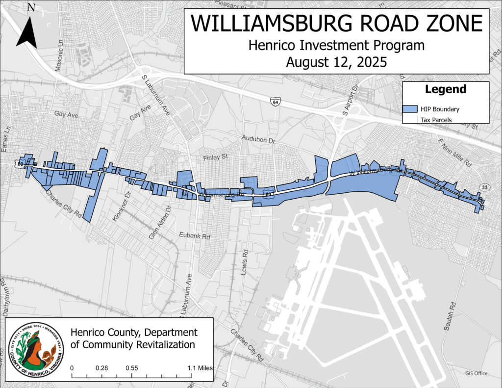
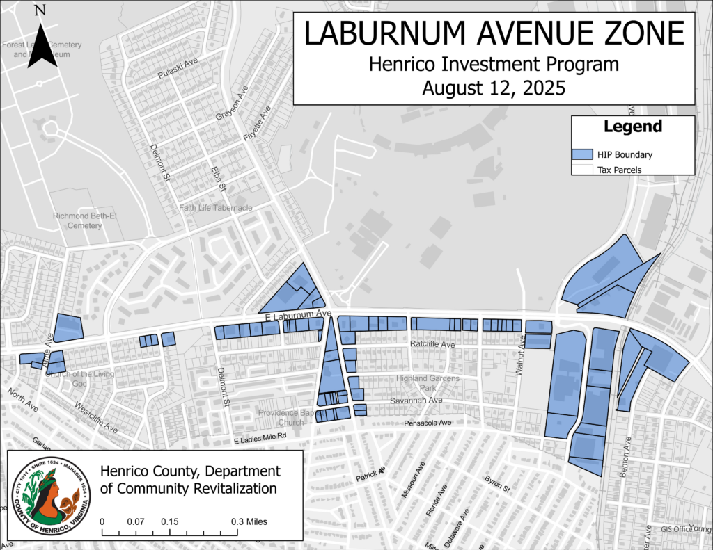
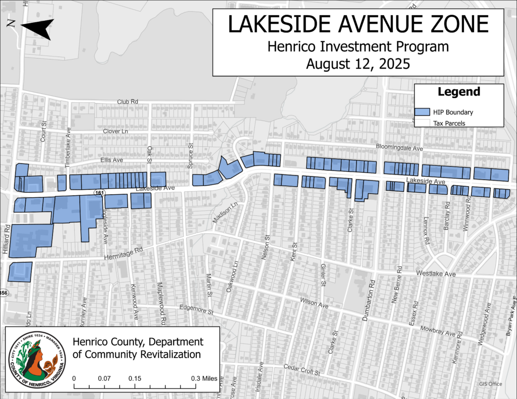
Henrico Investment Program Maps

Mechanicsville Turnpike Zone

Map showing the HIP Zone Mechanicsville Turnpike including large commercial areas on both sides of the road and running approximately 1.8 miles from Route 64 to Neale Street. The map was last updated August 12, 2025.

Patterson Avenue Zone

Map showing the HIP Zone along Patterson Avenue, which consists of several smaller, unconnected zones within the 4.25-mile stretch from Forest Avenue to the Western county line near Tuckahoe Creek Park. The map was last updated August 12, 2025.

Staples Mill Road Zone

Map showing the HIP Zone along both sides of Staples Mill Road beginning at Dumbarton Road and running approximately 2.5 North to Old Staples Mill Road. The map was last updated August 12, 2025.

West Broad Street Zone

Map showing the HIP Zone along West Broad Street including a smaller area at the intersection of West Broad Street and Horsepen Road and a larger commercial area on both sides of West Broad Street running approximately 3 miles Northwest from Route 64 to Springfield Road. The map was last updated August 12, 2025.

Williamsburg Road Zone

Map showing the HIP Zone along both sides of Williamsburg Road beginning just before Masonic Ln and running approximately 4.4 miles to East Nine Mile Road. The map was last updated August 12, 2025.

Laburnum Avenue Zone

Map showing the HIP Zone along both sides of Laburnum Avenue beginning just past North Avenue and running about 1.5 miles to Vawter Avenue.

Lakeside Avenue Zone

Map of the HIP Zone on both sides of Lakeside Avenue, beginning at the County line and running North 1.25 miles to Hilliard Road. The map was last updated August 12, 2025.

Nine Mile Road Zone

Map of the HIP Zone along a 5.3 mile stretch of Nine Mile Road. The zone is made up of several unconnected commercial pockets on both sides of almost the entire length of Nine Mile Road from the Western intersection with Route 64 to the intersection with Hanover Road.

Brook Road Zone

Map of the HIP Zone that spans nearly a 3.5 mile stretch of Brook Road. The zone includes a narrow area on both sides of Brook Road, a commercial area at the intersection of Brook, Mountain, and Telegraph and several disconnected pockets to the East and West. The map was last updated August 12, 2025.